River mile 37.4 – 38.4 (approximate)
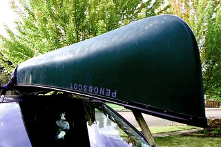
For our third paddle on the Tualatin River, we hoisted the barge on top of the van and headed to Hillsboro’s Rood Bridge Park.
Couple things about this park: 1) Damn, what a nice park. Clean, well maintained, and beautifully planted/restored. 2) It’s adjacent to the Rock Creek Advanced Wastewater Treatment Facility, which has significance we’ll talk about later.
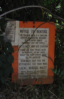
We first parked at the wrong end, where they were setting up for a wedding (or was it a quincea�era?). After a stroll through the grounds to a map, we drove to the other end of the park (take a right when you enter, not left), and found the river access point. There are a half dozen parking spots there, and a steep ramp that ends in a rough and steep dirt put-in area. Not ideal, but doable. Tualatin Riverkeeprs notes that there are many impassable logjams just upstream from this spot, so we headed downstream.
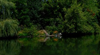
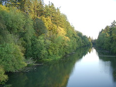
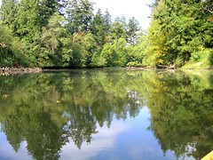
There was more current than our first two days of paddling, so we enjoyed a nice coast through a riverscape that could have looked the same 500 years ago. It’s so quiet once you get on the river, just birds and the breeze and the trickling sound of the water against the hull.
There were quite a few logs and trees to dodge, and just ahead a splashing sound and… white water? No, couldn’t be.
But something was going on. The water was foamy, and the closer we got, we could see there was some kind of high volume underwater discharge roiling the surface. What could it be, we wondered.
(Remember that sewage treatment plant? Oh, right.)
Anyway, there was a sign about it being “clean water” yada yada “air bubbles may cause harmless foam” yada yada and holy crap, we’re paddling through sewage. Didn’t smell too bad. Oh wait. It was a little stinky, but we convinced ourselves that it was just the usual river stank from algae and fish. We paddled on. Until we heard thunder.
Yeah, thunder. And then again. And again and again. It was 87 degrees and sunny, but somewhere just over the left bank there was a thunder cell unleashing frequent lightning. We turned back, judging it not the best place to be in a thunder storm. The banks of the river are very steep and thick with vegetation. No place to take out. So we paddled hard against the current, the storm cell seeming to pace us to our right, past the poop plant and back to Rood Bridge under a light sprinkle.
We landed between crawdad traps a couple had placed just after we put in, and hauled out. It’s a ten mile stretch from this spot to the next access point down river, so we probably won’t do this again until we’re ready to do a two-car one-way trip (next summer?) Next up (today, if weather cooperates): Schaumburg Bridge downstream to where we left off on day two.
 We’ve been busy busy busy this summer, so we only managed to get the canoe down last weekend. We took Junior out last Sunday and put in at Rivergrove, where we left off last year, and paddled downstream almost to Wanker’s Corner (yes, that’s a real place name).
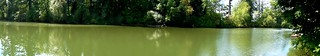
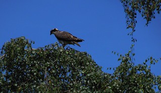 I recently bought a small point-and-shoot camera that I’m comfortable taking in the canoe, and the bird was patient enough to let me get a few shots off.