Tualatin River Diaries, Day 1
by Steve, July 28th, 2012River mile 9.8 – 11.5
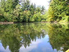
Photo by Greg Emel
Nancy and I are on a new mission: canoe the safely navigable length of the Tualatin River.
(Special thanks to friend and coworker D, who is letting us test drive his canoe and got us set up with everything. And he taught me a couple crucial knots I shoulda known from being a Cub Scout. Aye aye, cap’n!)
Most of the Tualatin Valley’s population is north of the river’s course, which runs out of the Coast Range near Hagg Lake and meanders through agricultural land and the Tualatin River National Wildlife Refuge south of Suburban Portland’s urban growth boundary. In our neck of the woods, it cuts between Cooper Mountain and Bull Mountain to the northeast and the Chehalem Mountains (Bald Peak) to the southwest, on its way to the Willamette River in West Linn.
Tualatin Riverkeepers, a nonprofit org dedicated to preserving and restoring the river, maps (PDF) about 33 miles of navigable water. This morning we paddled upstream from Cook Park (mile 9.8) the the 99W bridge (mile 11.5) and back.
We saw several happy paddlers in kayaks and one rowboat, as well as two Blue Herons (up close and personal), two Turkey Vultures (a little too close) and a large red-headed woodpecker. To the squirrel N initially mistook for a river otter: sorry for our disappointment, pal. (No pics; need a water-proof camera!)
Next up: 99W upstream into the Tualatin River National Wildlife Refuge.


